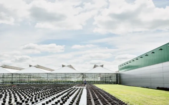
India is one of the major players in the agriculture sector worldwide, and it is the primary source of livelihood for ~45% of the country’s population. The sector plays a major role in supporting livelihoods and ensuring food security for millions. In addition to providing food, feed, fuel, and fiber to meet the growing needs of the burgeoning population, it supplies raw materials to the country's agri-based industry.
Climate change and depleting natural resources are seriously threatening agricultural productivity and incomes. To enhance agricultural production and farmers' incomes, remove poverty, and ensure food and nutritional security on a sustainable basis, suitable location-specific climate-smart agriculture technologies must be identified, created, and adopted at the field level. Integrated farming systems must also be promoted.
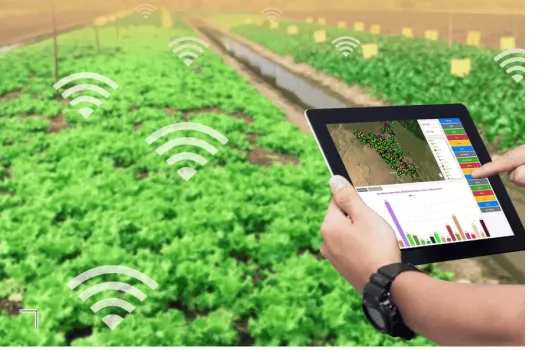
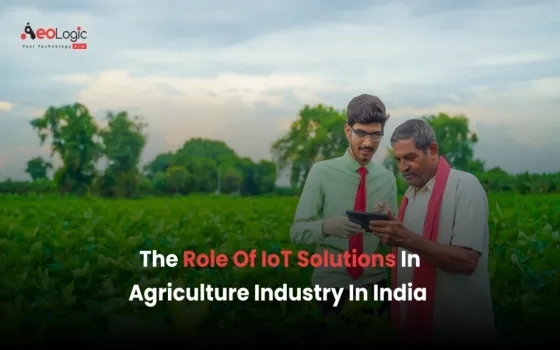
Modern tools and technologies such as GIS, remote sensing, AI, drone technology, crop modelling, site-specific nutrient management, and mobile applications must be adopted for farmers to make informed decisions about better nutrient management, reducing wastage, and minimizing environmental footprints. These tools can also significantly aid in improving farm productivity and farmers’ income.
GIS is pivotal in modern agriculture as it allows farmers to optimize resource utilization, reduce environmental impact, and tailor farming practices to the unique conditions of each field. The result is a more efficient, productive, and sustainable approach to agriculture, particularly through precision agriculture. ArcGIS is making agronomic understanding more accessible and empowering those responsible for feeding the planet.
Precision Farming
One of the major benefits of GIS is its role in increasing agricultural productivity, which is vital to global food security. By using spatial data to optimize planting patterns and resource allocation, farmers can achieve higher yields without expanding agricultural land. This technology enables precision farming, where each aspect of farm management is tailored to the specific needs of individual crops, resulting in better yields and more efficient resource use.
Precision agriculture is a modern farm management approach that focuses on observing, measuring, and responding to variability within and between fields. It aims to optimize farm inputs by targeting the inherent differences in the land through Variable Rate Application (VRA). To implement VRA effectively, detailed spatial data must be gathered across fields using tools like GIS and remote sensing. Some of the major precision farming technologies include precision irrigation systems, yield mapping and monitoring tools, and information management systems. By utilizing advanced descriptive, predictive, and prescriptive analytics, precision agriculture enables farmers to make data-driven decisions that promote cost-effective, environmentally friendly, and sustainable farming practices. According to the World Economic Forum, adopting precision agriculture technologies on 15-25% of farms could increase global food production by 10-15% by 2030, while reducing greenhouse gas emissions and water consumption by 10-20%, respectively.
Tools like ArcGIS play a crucial role in precision agriculture by providing farmers with detailed data about soil types, crop health, moisture levels, and other relevant factors. This information helps them monitor field variability, identify areas that need attention, and apply inputs like water, fertilizers, and pesticides more accurately.
Crop Health Monitoring
Instead of manual inspections, GIS enables remote monitoring of crop health using satellite imagery, providing insights about humidity, temperature, and overall growth. This helps in identifying areas needing attention. By monitoring changes in crop health indicators over time, GIS enables early detection of stress factors such as nutrient deficiencies, water scarcity, diseases, and pest outbreaks. Early identification allows farmers to take timely corrective actions, preventing potential yield losses and reducing the need for extensive interventions later in the season.
GIS also helps to monitor terrain slope and runoff patterns, enabling the stakeholders to track changes in soil health over time. This data can predict areas at risk of degradation, ensuring that timely interventions are made to prevent soil erosion and maintain long-term soil health.
Crop Yield Prediction
Accurate yield predictions are vital for food security and financial planning. Crop yield prediction using GIS involves combining spatial data with advanced analytics to forecast agricultural output. GIS integrates a variety of data types, including soil quality, topography, weather patterns, and satellite imagery, to provide a comprehensive view of the factors influencing crop growth. By mapping climate data such as temperature, precipitation, and growing-degree days (GDD), GIS helps farmers determine the optimal times for planting and harvesting to maximize yield. Soil analysis, through GIS-generated maps, identifies the nutrient levels, pH, and texture of the soil, guiding decisions on which crops are most suited for specific field areas. Remote sensing technologies, including satellite imagery and drones, provide real-time data on crop health, enabling early detection of stress factors like pests or nutrient deficiencies that could affect yield. Additionally, GIS incorporates historical yield data to predict future crop production trends, enhancing the accuracy of forecasts. With the integration of machine learning, GIS can analyze large datasets to create predictive models, allowing farmers to forecast crop yields with higher precision. Precision agriculture techniques, supported by GIS, enable farmers to optimize field inputs based on location-specific data, increasing efficiency and yield. Overall, GIS serves as a powerful tool for making informed decisions, improving crop management, and enhancing yield prediction accuracy.
Insect and Pest Control
GIS provides farmers and agricultural specialists with a powerful way to map, analyze, and manage pest populations, improving the efficiency of pest control efforts while minimizing the use of pesticides. By integrating spatial data with environmental factors such as temperature, rainfall, soil type, and crop distribution, GIS enables precise monitoring of pest outbreaks. It helps in identifying areas of high pest density, allowing for targeted interventions rather than broad-spectrum pesticide applications, which not only saves costs but also reduces environmental harm. GIS tools can also support the creation of predictive models, assessing how pest populations might spread based on climatic conditions, land use, and crop types. This predictive capability aids in early detection and intervention, preventing widespread infestations and crop damage. Furthermore, GIS plays a crucial role in Integrated Pest Management (IPM) strategies, where it assists in combining various pest control methods, such as biological controls, habitat manipulation, and chemical treatments, tailored to specific regions. By tracking pest populations over time, GIS also facilitates the evaluation of control measures, ensuring that pest management strategies are both effective and sustainable. Overall, GIS empowers agricultural professionals to make informed decisions, optimize pest control resources, and protect crops, thereby enhancing productivity and reducing environmental and economic risks associated with pest infestations.
Irrigation Control
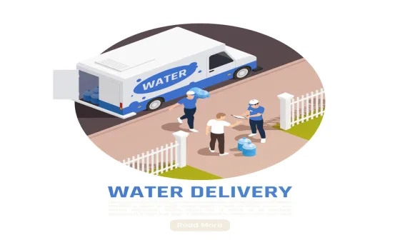
GIS facilitates the development of irrigation schedules tailored to specific field conditions and crop water needs. By analyzing spatial data on soil moisture, rainfall patterns, and evapotranspiration rates, GIS helps farmers and water managers optimize the timing, duration, and frequency of irrigation events to minimize water waste and maximize crop yields.
GIS can assist in monitoring water quality parameters such as salinity levels and contamination risks. By analyzing spatial data on soil types, land use practices, and proximity to sources of pollutants, GIS helps in identifying areas vulnerable to water quality degradation and implementing measures to protect irrigation water sources. As much as 70% of good water is used in agriculture, saving on this water use can help in addressing water stress. Wise usage of water can be made possible by adopting precision technology.
Crop Loss Adjustments and Payouts
In periods of catastrophic events like floods, heavy rainfall, drought, etc., GIS can be used to determine exactly how much of a given crop has been damaged and the progress of the remaining crop on the farm. GIS can generate crop condition and distribution analytics, leading to faster loss adjustment and payout to the farmers. In the crop insurance business, high-resolution imagery plays a key role in speeding up the claim process. Using ArcGIS and image processing software like ENVI, farmers and insurance providers can achieve the benefits of faster claim processes and payouts, visibility on in-season crop conditions at different time intervals fostering risk analysis and decision making, crop classification and crop risk analysis, acreage estimation of different crops, identification of inundation area and exposure monitoring, reduced operational and data processing cost, and more.
Sustainable Farming
Providing the current population and future generations with an indefinite food supply is an economic, environmental, and social concern. Geographic information system (GIS) technology enables community planners, economists, agronomists, and farmers to research and devise practices that will enable the sustainability of food production to ensure the survival of the human race. Whether implementing organic farming methods, finding the most profitable and healthy places to plant new crops, or allotting farmland for preservation to secure future food production, GIS has the capabilities to collect, manage, analyze, report, and share vast amounts of agricultural data to aid in discovering and establishing sustainable agriculture practices.
Farmers can make well-informed decisions based on precise spatial data, such as soil variability, moisture levels, and pest distribution. These insights allow farmers to treat specific areas of their land according to their exact needs, thus reducing waste and minimizing environmental harm. Recent studies indicate that over 70% of farms use some form of geoinformatics, making it a growing trend in agriculture. By integrating geospatial data, farmers are not only enhancing their productivity but also improving environmental sustainability.
GIS aids in sustainable farming practices by:
- Reducing carbon footprints: Optimizing farming practices to minimize the use of fertilizers, pesticides, and water.
- Preserving biodiversity: Identifying and preserving natural habitats and ensuring that farming practices do not damage the environment.
The Future of Agriculture
The future of agriculture lies in connected farms that are location-aware, with seed selection being an excellent starting point. Major seed companies invest in research on hybrid seeds, and with the advent of advanced technologies like IoT sensors, drone-based imagery, automated field equipment, and AI, they can capture more performance data than ever before. This wealth of information helps them understand which seed will perform best in specific locations, and more importantly, when to plant it to optimize growing-degree days for the best yield.
AI-based robots that can navigate fields to pick produce are another promising development in the agriculture sector. Significant investment is going into making this a reality, as these robots can be spatially aware, enhancing efficiency in harvesting. Additionally, the combination of drones and AI is transforming the way crop health and damage are monitored. Farmers can fly drones over their fields, and AI technology can analyze the images to identify potential problems, eliminating the need for field workers to manually scout crops. This capability allows farmers to quickly pinpoint issues in their crops.
Insurance companies are also using drones to conduct damage assessments and expedite claims processing. By deploying drones equipped with AI, they can distinguish between crops damaged by hail and those that remain unaffected, enabling a swift response that helps farmers recover more efficiently. Furthermore, machine learning models are being used to crunch vast amounts of data to support planning decisions. Farmers and seed companies are using historical weather data, past yield performance, and other relevant information to feed into location-intelligent systems. These systems continuously work to determine the optimal placement of seeds, while GIS technology provides the smart maps necessary to interpret the results.
Conclusion
GIS helps land use planners and managers select the best sites for agricultural projects. It can be used to map the location of resources such as water, soil, and transportation, as well as the location of potential hazards such as flooding and pollution. This information can be used to identify sites suitable for the proposed agricultural project and unlikely to be affected by hazards. By collecting data from field samples or sensors measuring soil characteristics such as texture (sand, silt, clay), organic matter, pH, electrical conductivity, and nutrient levels (nitrogen, phosphorus, potassium), stakeholders can generate detailed soil maps. These maps aid in visualizing spatial variability in soil properties, allowing for targeted application of fertilizers and soil amendments (e.g., lime, organic matter) at varying rates based on the specific needs of different areas within the field. Also, suitability analyses, facilitated by GIS, help the stakeholders to determine the optimal crops for each plot of land, based on its soil, climate, and social conditions, and conceptualize the best practices at all stages of the farming season. This understanding helps in improving farm productivity and farmers’ income.
By utilizing GIS, agriculture becomes more efficient, sustainable, and cost-effective. Farmers can make better-informed decisions, leading to increased productivity, reduced environmental impact, and improved food security. GIS in agriculture offers a powerful approach to optimizing the management of resources, crops, and land, which is essential for meeting the growing global demand for food. GIS supports crop health monitoring through multispectral and hyperspectral imagery, which can detect early signs of plant stress or disease. This proactive approach allows farmers to address issues before they escalate, further enhancing resource management.
As technology continues to evolve, its role in precision agriculture will only grow, contributing to higher productivity, improved environmental sustainability, and a more resilient agricultural sector. Using GIS, predictive models can be developed to forecast crop yields based on historical data and current environmental conditions. By embracing GIS and other advanced technologies like AI and IoT, the agricultural community can move towards a future where farming practices are both efficient and sustainable, ensuring food security for generations to come.


Comment
Geographic Information Systems (GIS) are revolutionising agriculture by enabling precision farming and efficient resource management. With applications like crop monitoring, soil analysis, and irrigation management, GIS can increase yields and sustainability. However, how can farmers, particularly in emerging economies, overcome barriers to accessing and using GIS technology, ensuring these innovations reach a global audience for food security?